SILBURY AND EDWARD DUKES LINE
1. INTRODUCTION
It is a curious fact that lunatics never will believe that they are insane, wrote the Wiltshire Trust, reviewing The Druidical Temples Of The County Of Wilts in 1846. The lunatic in question who had written the offending work was Rev Edward Duke, an antiquary who lived at Lake House in Wilsford cum Lake, near Amesbury (Grid Ref: SU 1338). A century or so later it became domicile to Sting and family, although on 5 April 1912 it had been gutted by a fire and completely rebuilt.
Rev. Edward Duke, M.A. F.A.S. F.L.S. was baptised on 24 September 1779 at Hungerford. He went to Magdalen Hall, Oxford, and got his MA in 1807. He was also a magistrate, and a member of the Archaeological Institute of Great Britain and Ireland. He died, 6 years after publishing his theory, on 24 August 1852. His widow, Harriet moved to 15 Camden Crescent, Bath, and died 25 January 1873. They are both buried at Wilsford.
Duke's unsympathetically received theory of druidic temples inspired his reviewers to say, It has seldom been our unhappy fate to wade through a book in the pages of which we could find less instruction of any kind, or a larger number of the most puerile absurdities
The Wiltshire Trust attributed some of the blame for the book to the exuberance of youth and seemed of the
belief that its author was a naive young man, rather than a retired cleric. They may have been under the impression that the author was
32-year old Edward Duke Jnr. He was born 6 December 1814 at Ivy Church (baptised 11 July 1815, Wilsford)
and became curate of St Edmunds, Salisbury, and of Wilsford. He died 11 October 1895 at Wickham Rectory, and is also buried at
Wilsford.
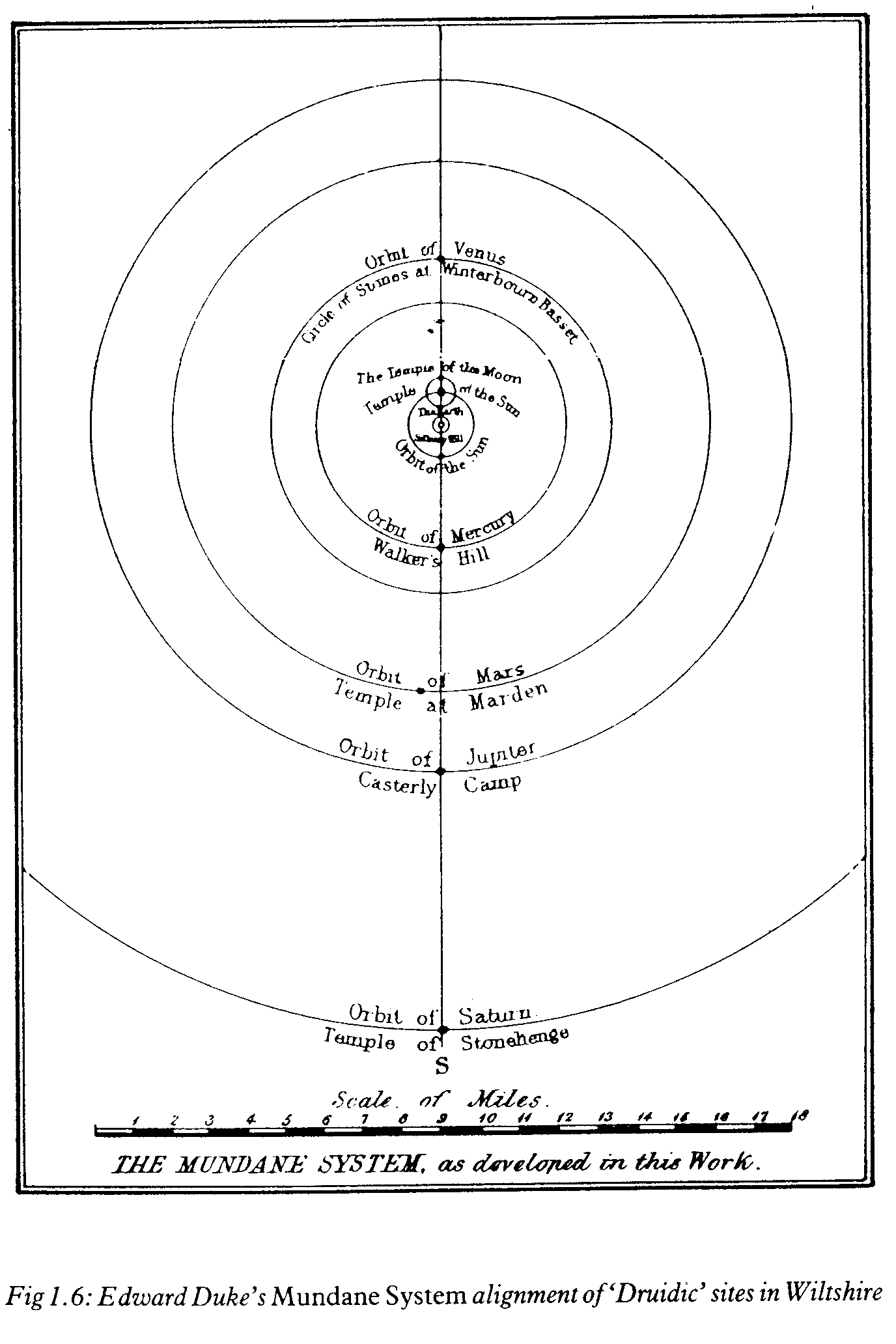
Dukes theory was that the Druids had built a giant planetarium in the land, with temples, representing all the planets known to ancient man, in apparent orbit around Earth. In his diagram the Moon is bizarrely depicted in a separate orbit around the Sun. Duke has not made note of any occurrence at the South node, so this representation is pure conjecture on his part.
He
placed Silbury Hill in Wiltshire as the druidic mystic centre which represented Earth, and depicted the traditional planets at temples situated along what would now be called a ley-line (the Duke Line) which is at 275 degrees (5 degrees Capricorn), where 0 degrees is West (0 degrees Aries).
Planets with male associations such as Mars were shown at the South point of the orbit where they crossed his ley-line (South node), and those that were traditionally female like Venus were shown at the North node. The exception to this was the Sun, a masculine "planet" which is incorrectly represented at its North node. This and the Moon's orbit as depicted by Duke lead me to wonder if he originally considered Silbury Hill to represent the Sun, in which case Avebury would become Earth, a feminine planet which would correctly be placed to the North of the centre, and which would be orbited by the Moon. Then, when he realised that his Druids would not have placed the Sun at the centre he swapped them around without making any further modifications.
In The Druidical Temples Of The County Of Wilts (dedicated 13th August 1846, Lake House, Amesbury), he wrote that our ingenious ancestors portrayed on the Wiltshire Downs, a Planetarium or stationary Orrery, if this anachronism may be allowed me, located on a meridianal line, extending north and south, the length of sixteen miles; that the planetary temples thus located, seven in number, will if put into motion, be supposed to revolve around Silbury Hill as the centre of this grand astronomical scheme; that thus Saturn, the extreme planet to the south, would in his orbit describe a circle with a diameter of thirty-two miles; that four of these planetary temples were constructed of stone, those of Venus, the Sun, the Moon, and Saturn; and the remaining three of earth, those of Mercury, Mars, and Jupiter, resembling the Hill Altars of Holy Scripture; that the Moon is represented as a satellite of the Sun, and, passing round in an epicycle, is thus supposed to make her monthly revolution, while the Sun himself pursues his annual course in the first and nearest concentric orbit, and is thus successively surrounded by those also of the planets, Venus, Mercury, Mars, Jupiter, and Saturn; that these planetary temples were all located at due distances from each other; that the relative proportions of those distances correspond with those of the present received system; and that, in three instances, the sites of these temples bear in their names at this day plain and indubitable record of their primitive dedication.
Duke took some considerable poetic licence with his locations and his distances, and his meridian ley-line does not run due North/South as he claims (although another true meridian ley-line does also pass through Silbury Hill). Furthermore, we now know that his belief, widespread at the time, that the Druids were the creators of all these stone and earth monuments, was completely wrong, the truth being infinitely more marvellous and strange, and impossible to completely discover.
However, it is an intriguing theory and there are significant sites at more or less all the places they were required to be according to his theory. Despite the propensity of these monuments, especially prior to the industrial revolution, the likelihood of this happening by chance is very small, especially as two of his temples are Stonehenge and Avebury, two of the most important monuments in Europe.
His observation that these locations all fall on a straight line and the significance he ascribes to this predates Alfred Watkins rediscovery of ley-lines by nearly a century, and as such he must be afforded due credit.
Edward Duke's Sketch Of "that portion of the County which includes the Temples described"
2. EDWARD DUKES TEMPLE'S NODAL POINTS
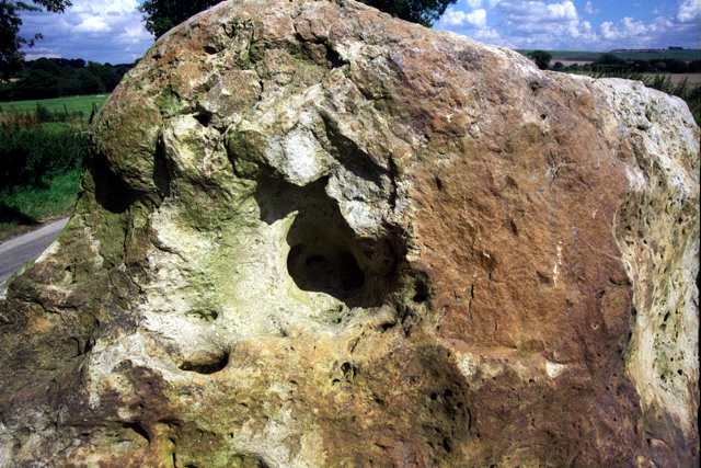
EARTH: SILBURY HILL
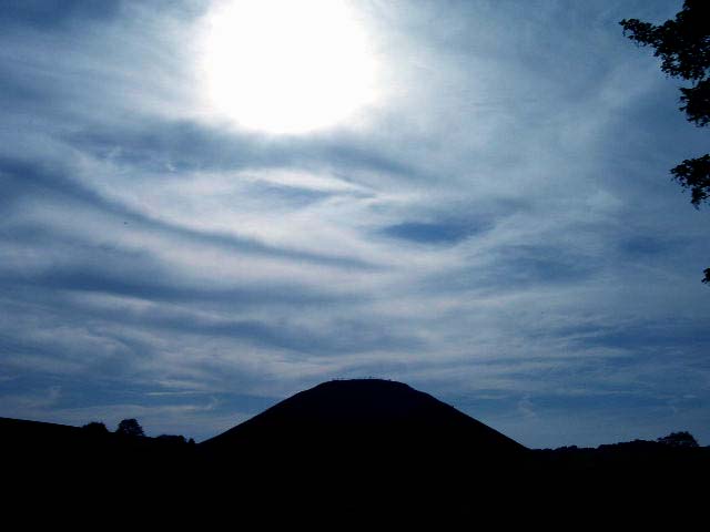
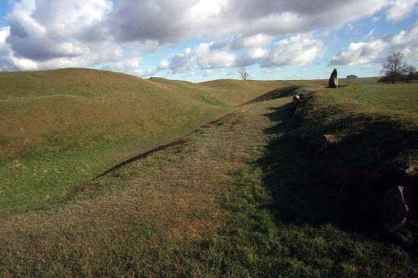
All Edward Dukes temples radiate from Silbury Hill, which lies at the centre of the whole 4,700-year old Avebury complex, uniting Avebury Henge, the Sanctuary, both Avenues, the Kennet Long Barrows and Swallowhead Springs. The great natural Silbury Prime Meridian ley line runs through it.
The true age of these Neolithic monuments was greatly underestimated at Dukes time, as the Druids arrived thousands of years later. It is unlikely that they appropriated the structures for their own dramatic purposes, as they worshipped in sacred forest groves and had no need of stone monuments. It was the seventeenth century antiquary John Aubrey who connected these stone artifacts with the Druids. Roman writers such as Julius Caesar had written of a Celtic priesthood, flourishing at the time of their arrival, 1,500 years after the last stone monuments had been constructed, but had not linked them to Avebury or other similar sites, which by then had probably been in ruins for hundreds of years. Celtic society came into existence in Britain only after 300 BC.
As recently as 1965, Ross Nichols (b. 26 June 1902, Norfolk), chosen chief of the Druidic Association, was championing Dukes Axis of Powers in his book The Time Stones Of The Druids.
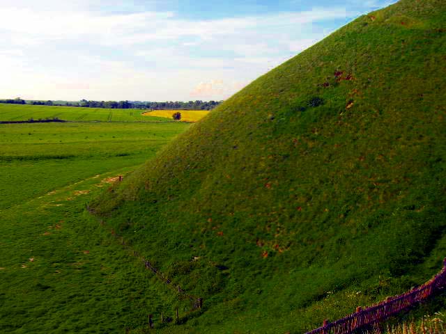
Silbury Hill is thought to date from between 2800 and 2400 BC (the New Stone Age). Topped in turf, its shape is much unchanged from that time. This and several other remarkable British and Irish megalithic structures predate any evidence of astronomical and mathematical cultures elsewhere in the world. In The Silbury Treasure, Michael Dames shows that Silbury Hill, which is aligned with midwinter and midsummer solstices, was built on a ley line that runs from Avebury Henges west entrance to Milk Hill, and indicates that all full moons and all mid-day suns reach highest altitude on this line. To the Neolithic Wessex man it could well have represented the centre of the Earth itself, dedicated perhaps to Gaia, the Earth Goddess.
The name Silbury (Seleburgh in the 13th Century) may derive from Sul (or Suil, meaning eye), a goddess venerated by the Britons; or Sol, the Roman god. "Sol", of course, means "Sun", so it would be easy to argue that Silbury represented the Sun rather than the Earth.
Duke quotes Cooke from an anonymous and brief account of Abury, Stonehenge, &c. principally combined from the works of Stukeley, and printed by B.C. Collins of Salisbury: The name of it is corrupted by the country people, and was either written or pronounced Silbarrow; and then it signifies no more than the peaceful grave, or, which is more likely, it was called SIL BARROW, the large or elevated barrow.
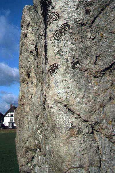
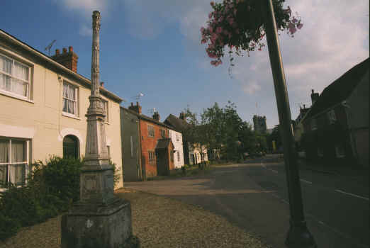
THE SUN (North Node) AND MOON (North Node): AVEBURY
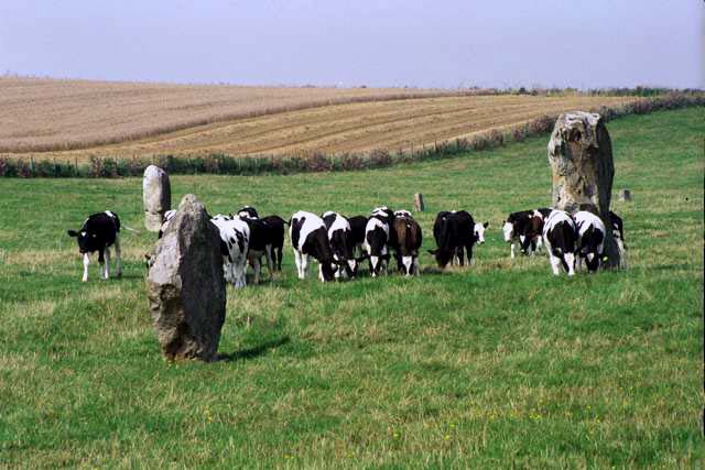
Lord Avebury (b. 29 September 1928) owns Avebury and Silbury Hill at the time of writing. His grandfather, the archaeologist and prehistorian Sir John Lubbock bought it when the henge stones included in the lot were about to be used as rubble by a builder. He introduced the Ancient Monuments Bill to safeguard our heritage, and gave to them the lease of the hill and henge land.
Duke writes that, The temples of Sun and Moon, the temples of Mercury, Venus, Mars, Jupiter and Saturn are located respectively at distances of 1,3,4,6,9,16 miles from Earth. The diameter of their respective orbits would be therefore 2,6,8,12,18,32 miles. The temples are all placed on a right line, due North and South.
Avebury, approximately 1 mile from Silbury Hill, therefore represents both the Sun and the Moon, and within its stone enclosure there are two stone circles, known as North Temple, representing the Moon, and South Temple, for the Sun. Both lie slightly to the East of Duke's line, as if they were on his meridian, and are situated diagonally to each other, not North and South.
Avebury may originally have been a small town in the Stone Age. Recent excavations have
revealed evidence that several hundred people lived within the sites with their
sheep and cattle, the stone circles having been added later to a part of the
settlement. The archaeologist Aubrey Burl has said, "I think that Avebury's earthwork is very similar in size to several others in Wiltshire and Dorset and, almost certainly, I think they are settlement
sites. This is because of their size but also because the remains of timber structures, probably houses, have been found."
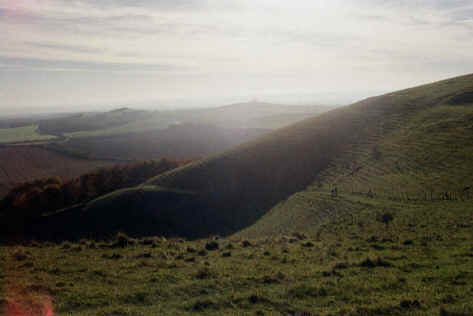
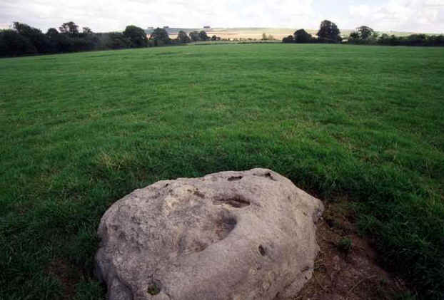
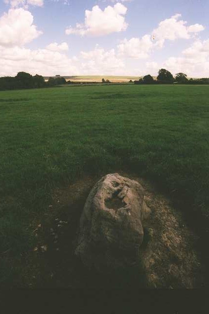
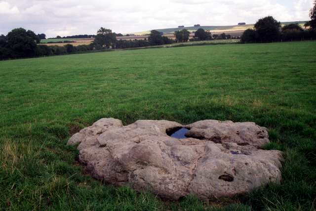
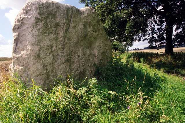
MERCURY (South Node): WALKERS HILL
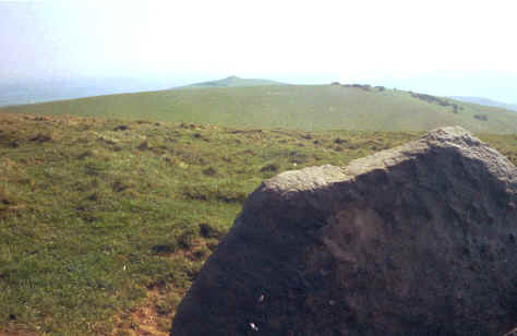
Walkers Hill (or Walkway Hill) is near Alton Barnes. A large Neolithic long barrow, 200 ft by 20 ft, caps it, known as Adams Grave. This is Dukes temple to Mercury. It used to be called Wodnes beorb (Wodens Barrow) and aligns to the midwinter sunrise. It was conjectured by Sir RC Hoare to be a Hill Altar, or sacred mound, as at nearby Marden (now destroyed), which is Dukes Mars site.
There was a probable Woden cult above the Vale of Pewsey. Woden was the Teutonic or Norse principal god, who granted heroism and victory and decided man's fate, and was the god of spiritual life. From Woden comes the fourth day of the week, Wednesday, which is Mercredi in French, Mercury dies in Latin, Mercury being the Roman equivalent.
3-4 skeletons were discovered in Adams Grave in 1860. There is a legend that if you run around it 7 times, a giant emerges. A battle between Upper Thames Saxons and West Saxons, led by the Saxon kings Ine and Ceolred, was fought there in 715 AD.
The Ridgeway footpath passes between Walkers Hill and Knap Hill and the Wansdyke crosses it, also passing Tan Hill, Adams Grave and Knap Hill.
The adjacent Knap Hill is surmounted by a Neolithic causewayed camp or enclosure c. 3500 BC, which could be the oldest known communal dwelling in the country. It overlooks East Field, a site of great pagan significance, and reputedly contains treasure.
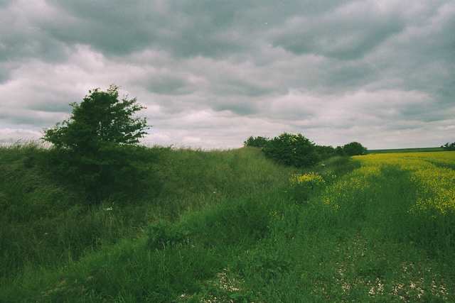
VENUS (North Node): WINTERBOURNE BASSETT
At Winterbourne Bassett stone circle, 4 miles north of Avebury, Edward Duke infers from the remains an outer circle of 30 stones (a cycle of days of the month) and an inner circle of maybe 12 or 19 stones (representing either months, or the Metonic cycle). The half-dozen or so of these stones which remain lie peacefully in a recumbent position providing rock pools. They are also connected by another ley line to a stone circle in Coate, Swindon, via nearby Broad Hinton church.
The pictures were taken on 19 August 1999.
The original circles size and apparent complexity suggest it may have been an important ceremonial site in Neolithic or Bronze Age times. Its inner circle was 50-55 yards in diameter, and its outer circle was 75 yards.
In 1743 William Stukeley wrote, At Winterburn-basset, a little north of Abury, in a field north-west of the church, upon elevated ground, is a double circle of stones concentric, 60 (sic) cubits diameter. The two circles are near one another, so that one may walk between. Many of the stones have of late been carryd away. West of it is a single, broad, flat and high stone standing by itself. This gnomon of the temple (as Duke describes it) would have been sited to the West, as Venus is more easily observed in the evening. Stukeleys sketch can be seen at the Bodleian (as Gough Maps 231, fol. 216).
The marvellous standing stone now beside the opposite road junction is probably not the original gnoman, as a farmer reputedly erected it there in 1996. To the north of the stone circles is a brook from a winter spring, which combines with others to form the source of the Winterbourne stream, and flows through Winterbourne Monkton. The grave of Rev Brinsden there is marked by a sarsen stone that came from a chambered long barrow nearby called Millbarrow (SU 0943 7220), which was heavily damaged before being totally destroyed by a new landowner in 1967. Below Hackpen Hill is a long mound with a few sarsen stones still in existence (SU 1163 7230).
Seven megaliths, the remains of a bell barrow called Avebury Down Stone Circle, are still visible nearby (SU 1142 7126). (Approach from Avebury, west up the hill to the downs - along Green St - before turning N at SU 1137 7044 - where a direct track to
Hackpen Hill is signposted).
MARS (South Node): MARDEN
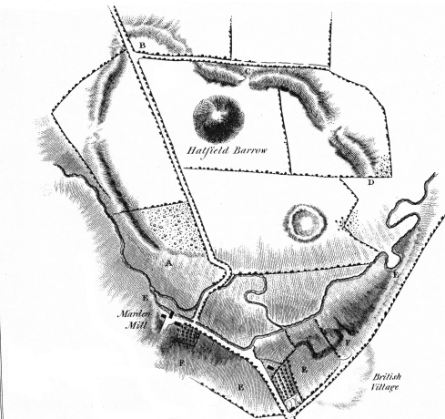
Marden Henge illustrated by Philip Crocker, from Sir Richard Colt
Hoare's
Ancient
Wiltshire (1812)
Marden Henge earthwork in the Pewsey Vale is the largest henge monument in Britain, its oval shape enclosing 35 acres. Sited with the River Avon at its south-eastern perimeter and dating from 2,400 BC it originated as a Neolithic settlement but was also used for ritual purposes, and later became a henge. It linked the people of Stonehenge and Durrington to Avebury.
Inside the henge stood the impressive Neolithic Hatfield Barrow. It was said to be well over 400 feet in diameter and 22ft high. According to legend, it concealed treasure, and this proved its undoing for following extensive excavations by Sir Richard Colt Hoare and William Cunnington in 1809, it tragically collapsed, without anything of consequence having being found. It was already a ruin by the time Duke came to view it, and by 1819 Hoare had written that "no signs remained of its previous existence".
Duke writes, Marden (although local appellatives are usually derived from the Saxon) is derivable from the ancient British words Mars and den; the one (according to the Ductor Linguarum, of Minshieu) signifying the planet Mars, and the other, a cave or residence. What have we then but the temple of Mars?
However, elsewhere a more widely accepted but different interpretation of the name has it dedicated to the Great Goddess Ma, which fails to suit Duke's plan.
Duke goes on to explain with regard to his straight line that Marden, on an extent of 32 miles, will be found about half a mile to the left out of the strict line; and this slight deviation, which at first sight would appear to disprove, in reality confirms, our rule: for upon investigation it is found, that this temple, if sited on the meridianal line, must have been looked for in the bed of the neighbouring river, and even as it is, if at the present day a spectator place himself at the temple of Mars, in the centre of the vale of Pewsey, and look alternately at the temple of Mercury, and at the temple of Jupiter, sited respectively on the summit of the northern and southern hills bordering on that vale, all the three temples will appear to be on a straight line.
Duke's mileages from Silbury Hill begin to go awry at Marden, which is further from Silbury than he calculates, and by the time Stonehenge is reached the errors are running into several miles.
Limited excavations of the Marden monument took place in 1969. The ditch terminal and bank terminals at the north entrance were examined and a timber structure was found.
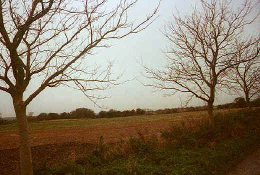
JUPITER (South Node): CASTERLEY CAMP
Casterley Camp was an ancient military camp on the edge of Salisbury Plain. It consists of 60 acres enclosed within a rampart 30ft high, much valued by antiquaries as a probable British town.
It is still a military site and to take these pictures permission for myself and Maria Wheatley to enter had to be obtained from a sentry officer, who also rang through to the farmer to grant access to the camp construction itself. The pictures, taken on 23 June 1999, show the ditch, henge, henge path and mound.
It is now believed that Marden, Casterley Camp and Walkers Hill were all military camps, not religious temples as claimed by Duke. He quotes Sir Richard Colt Hoare to validate his theory, There is an inner enclosure, which, by having the ditch within the vallum, denotes probably a place appropriated to religious purposes.
Duke also finds 4 miles south of his temple of Jupiter, a long barrow seated on the top of an eminence, with a long and gradual ascent on either side. This tumulus is known by the name Knighton Long Barrow. The view from it is very extensive, and whilst from hence the temples of Jupiter and Saturn are fully seen, yet from the interposition of the hill, the mutual view from each other is precluded. I regard then this tumulus to be raised as a telegraphic point, as a guide to and from these temples for their various religious visitants, at their grand periodical festivals.
SATURN (South Node): STONEHENGE
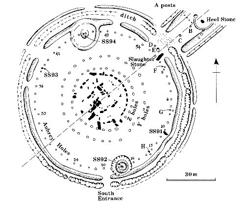
Illustration from Rodney Castleden - The Making of Stonehenge. London and New York:
Routledge, 1993
The stones are great
And magic power they have
Men that are sick
Fare to that stone
And they wash that stone
And with that water bathe away their sickness
Layamon, AD 1200, in his poem "Brut", describing
Stonehenge
On 21 September 1915 a Mr CH Chubb bought Stonehenge and 30 acres for £6,600 from Sir Edmond Antrobus, as a gift for his wife. Considerable as this sum was, it shows how recently Stonehenge has acquired the worldwide iconic status it now enjoys.
Part of its current popularity can be attributed to the Oxford University engineer Alexander Thom and the astronomer Gerald Hawkins, who in the 1950s and 1960s pioneered archaeoastronomy - the study of the astronomies of ancient civilizations. They concluded that the stone rings at Stonehenge were used as astronomical observatories by means of unprecedented sophisticated mathematical and engineering skills, involving precise alignments and geographical positioning.
More recently, studies by Aubrey Burl and Benjamin Ray have tempered some of these earlier claims, and suggest its primary use was ritualistic, with a secondary astronomical or calendrical purpose. Possibly it was intended as an imperishable replica of the kind of wooden sanctuary that was common in Neolithic times, such as the nearby Woodhenge.
In 1987, Ray writes, "Hawkins (in 1964) asserted the existence of twenty-four solar and lunar alignments at Stonehenge, and he proposed the theory that the monument could have been used as a calculator to predict eclipses....However, it is now recognized that Hawkins was clearly wrong about Stonehenge's possible use as a calculating machine to predict eclipses. And it is also agreed that he overestimated the number of solar and lunar alignments involved....The 'discovery' of known alignments in megalithic sites has give the impression of remarkable astronomical knowledge on the part of late Neolithic builders, whereas in most cases the precision involved derives fundamentally from the investigator who knows the relevant alignments in advance and 'finds' them in the site."
Stonehenge probably began as a large earthwork, or henge, constructed approximately 5,000 years ago by an indigenous people of the late Neolithic period known as Beaker Folk, when they first began to use metal implements and to live in a more communal fashion. The first stone circle, the inner circle, began to appear around 2,000 BC, using bluestones from the Prescelly Mountains in Wales. They weighed up to 4 tons each, and about 80 were set up before the ring was abandoned before it was completed. The giant sarsen stones for the outer circle weigh up to 50 tons each and came from the Marlborough Downs. Though much nearer, the problems of transport must have been considerably greater. At least 600 men would have been used merely to get each stone past the steepest part of the route, at Redhorn Hill.
It has been estimated that all three phases of construction entailed more than thirty million hours of
labour.
The outer ring was probably not complete until 1,500 BC, yet it is unlikely that Stonehenge was
still functioning just 400 years later. It is such a monumental achievement that no
twenty-first century theory can fully explain away its mystery, let alone the
imperfectly understood received wisdom prevailing at the time of Edward Duke.
3. THE ALTERNATIVE NODAL POINTS
These temples all occur on or close to Duke's line, but whether they occur to the North or South of the central Silbury Hill depends on whether they represent male or female planets. As each planet's orbital path must cross the line twice on each revolution, once at the North point and once at the South, having plotted Dukes straight line I wondered what, if anything, might be found at the opposite nodes of each planet, and if so whether they had any significance. It would be fascinating if there were any "temples" at these sites, but it would also increase the likelihood that that the presence of sites at each of Duke's significant points could be happenstance.
The South node of the Sun is marked by a Mound, due South of the Avebury stone circles and henge. As the Sun was regarded as masculine this should properly be the site of any temple to the Sun in Duke's planetarium. If, on the other hand, this orbit depicts that of the Earth, it should have no significance.
The South node of the Moon in its mini-orbit coincides approximately with the Southern side of the circular henge at Avebury. The South node of its major orbit around Silbury Hill is at a site of no visible significance.
Mercury can traditionally be male or female, so although Duke has shown it its South node, its North node is the most likely of all the traditional planets to have significance. I calculated it would be above Monkton Field to the west of Berwick Bassett, and if there ever was a monument there, no trace of it remains.
The South node of Venus would pass close to the Barge Inn, appropriately a place of pleasure, and coincidentally a centre for crop circle researchers, beside the Kennet and Avon canal at Honey Street.
The north node of Mars lies in the village of Broad Town. As Marden Henge lies slightly to the west of the Duke line, symmetrically one might look correspondingly to the east of the line for its north counterpoint, and one would be rewarded with a chalk white horse, though not of any great antiquity.
The north node of Jupiter falls in an area of Wootton Bassett known as Woodshaw, close to a roundabout. I'm afraid this circular feature is as close as we get to anything geodetic.
The north node of Saturn is slightly more rewarding as falls directly over a river in what is now the Cotswold Water Park, between Ashton Keynes and Cricklade, and the river turns out to be the same River Thames or Isis that flows through our great capital, and so could once have been a site of some significance.
4. TEMPLES FOR THE UNKNOWN PLANETS
Duke believed that these temples, as he called them, occurred at these sites by design, a great design that mirrored the paths of the celestial bodies in the earth, forming a vast planetarium 32 miles in diameter, and incorporating such well known monuments as Stonehenge, Silbury Hill and Avebury. All the planets known to ancient man, plus the Sun and Moon, are represented, in an approximation of true scale.
We now know that there are other planets, not visible to the naked eye, discovered long after the ancients had abandoned these enigmatic monuments, but present all along. Where would they be located? Might they prove to have monuments or natural features present, due to the miracle of synchronicity or of other great forces at work? Would there perhaps be equivalent sites for those undiscovered outer planets at their locations? After all, they must also have the same symbolic significance.
How would one calculate where they would be? None of these planets are actually orbiting Earth, and their orbits are in any case not circular, so the planetarium is not astronomically accurate. As we reach the outer planets these anomalies become increased. For example Pluto has a mean distance from the Sun of 3,666.874 million miles (39.54 AU, where the distance between Sun and Earth is 1AU or 93 million miles) but this can actually vary from between 2,750.156 million and 4,583.592 million miles due to its elliptical orbit. Any planets distance from Earth will further differ quite dramatically depending on which side of the Sun it lies.
The inner planets mean distances from Earth are 0.613AU for Mercury and 0.277AU for Venus. Mars can be between 128.005 million and 154.726 million miles from the Sun, but from Earth it may be only 34.6 million or as much as 235 million. This gives it a mean distance from Earth of 134.8 million (1.45AU). Jupiter, 350 million miles beyond is 5.21AU from Earth. Saturn is 9.55AU, Uranus 19.2AU, Neptune 30.07AU and Pluto 39.54AU approximately.
If one applies the same symbolism that Duke assumes was used by the ancients, then it is the mean distance of the outer planet from Earth in an imagined circular orbit that is of geodetic relevance.
Dukes planetarium is not accurately to scale, so any system built around it has an in-built imprecision, or flexibility, but an approximation calculated from the distances from Silbury to his Jupiter and Saturn sites suggests a scale of 1AU corresponding to about 1.8 miles. Distances from Silbury would therefore equate to approximately 35 miles to the scaled orbital path of Uranus, 55 miles to Neptune and 72 miles to Pluto.
THE ASTEROID BELT (North Node): COTMARSH
Perhaps the most notable new orbital path would be that of the asteroid belt, as it lies within the Solar System as perceived by Neolithic man, between Mars and Jupiter. This belt includes Europe-sized Ceres, the largest asteroid, and Vesta, established in 1995 as the true sixth terrestrial planet, being the only asteroid to have its own molten core, like the Earth. Although not discovered until the 19th Century, one or two of the largest asteroids can become visible to the naked eye, and are viewable through binoculars or telescope in the right conditions. There is a theory that many of these small bodies are fragments from a much larger planet which was destroyed in a planetary collision.
Most of the major asteroids, including Ceres and Vesta, have been classed as female, so it was the North node of the asteroid belt that would be of most geodetic interest, and this point proved to be near the homestead of Cotmarsh. Its South node would be on Cleeve Hill, near Charlton, on the edge of Salisbury Plain.
I visited the Cotmarsh site with Maria on 7 July 1999. She used her dowsing rod to lead us to what she believed to be the actual spot, which lay in a peaceful field with wild flowers and grazing horses, duly nicknamed Ceres, Pallas and Vesta. As the existing sites had apparently been dedicated to the planets they represented, it seemed appropriate to dedicate this site to the asteroids of the asteroid belt, and so Maria performed a small ceremony and placed two crystals there.
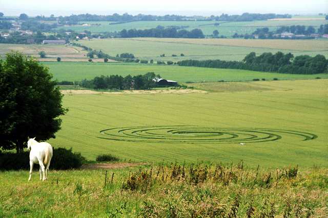
Returning from Cotmarsh we came across this nearby crop circle below Hackpen Hill, which I subsequently discovered had appeared 3 days earlier on 4 July. Above us was a chalk white horse, so it seemed appropriate that there should be a real one in the field also.
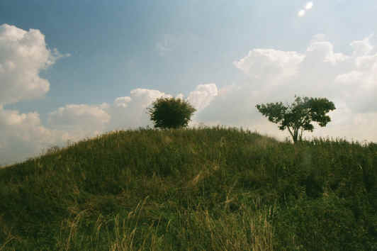
URANUS (North Node): BELAS KNAP
Uranus, being a higher octave of Mercury, can be classed as male or female so both nodes were considered. Using this rough and ready methodology and some intuition the north Node of Uranus was found to be the most significant, situated at Belas Knap, a fine neolithic long barrow near Charlton, on the Cotswold Way ancient path, which dates from about 3000 BC. Belas is thought to derive from an ancient storm god, Baal (Belus in Latin), and Knap is Old English for the crest of a hill.
Its South node would be near the River Avon in the region of Fordingbridge in Hampshire, between Alderholt and North Gorley.
NEPTUNE (South Node): CHRISTCHURCH HARBOUR
The Duke line reaches the South Coast at Hengistbury Head, the mouth of both the Wiltshire/Hampshire Avon and the River Stour, in Christchurch Bay, near Bournemouth, and this appropriately watery spot is where the South node of Neptunes underwater domain is to be found.
Ten barrows on the Head date from about 3,500 years ago, constructed during the Bronze Age, long after an earlier settlement had vanished. Early Iron Age settlers were attracted to Hengistbury Head by
its ironstone boulders, and it quickly became an important international trading port up to the Roman invasion, exporting gold, silver, copper and iron, and importing wine, glass and luxury items. Later Hengistbury became a major settlement for the local Durotriges tribe.
This tale quoted from Jennifer Westwood's Albion: A Guide To Legendary Britain seems most appropriate: In 1112, the cathedral of Laon in France was destroyed by fire and funds had to be raised in order to rebuild. A party of canons was formed to take the cathedrals famous shrine of the Virgin Mary and other relics on a tour of northern France asking for donations. So successful was this that rebuilding began almost at once, but by 1113 money was running short again and a new fund-raising tour was planned. This time the Canons went to England, where they were well received everywhere except at Christchurch. Here the Dean bitterly resented their visit, for he found that the offerings of rich merchants on which he had relied to finish the building of his own cathedral were being given instead to the shrine of the Virgin. He turned the Canons of Laon out into the rain with their shrine and their relics, but hardly had they left when there rose up out of the sea a five-headed dragon, spewing brimstone and fire. Those who had befriended the Canons the monster spared, but wrought utter havoc on the lands and livestock of the rest.
This jolly little story was told by a monk who signed himself Hermann monachus, usually identified as Hermann of Tournai, writing c. 1146 (d. c. 1147).
Could the sea dragon have been Neptune himself?
Neptunes North node lies near Alcester, which is on the Ryknild Way.
PLUTO (North Node): LICKEY END
Since the South node of Pluto fell within the English Channel only the North nodes could be considered, and Pluto is considered feminine in some astrological disciplines. Following the Duke line North from Belas Knap towards Redditch, the Duke line runs for awhile alongside the Ryknild Way, a Roman Road that lies at 280 degrees (10 degrees Capricorn), and continues until Pluto is found to reside in the infernal depths of Bromsgrove, north east of that town itself, at the point where the Duke line crosses another Roman Road, at the foot of the Lickey Hills, near Lickey End. It is fitting to imagine the god of the Underworld making his home below the dark hills that mark the start of the Black Country.
How far the line extends northwards is not yet known, but it is interesting to note that if followed to its
logical conclusion, it takes us to John OGroats, the most northerly point of Britain.
Copyright © 1999-2007 [Laurence Upton]. All rights reserved.
Last updated: November 06, 2007